London remote sensing study yields wealth of real-world vehicle emissions data
Researchers recently completed an intensive vehicle emissions measurement campaign in London, which will provide valuable information about the real-world performance of the city’s motor vehicle fleet.
The campaign, carried out by Opus RSE and Ricardo, is the first of two pilot studies planned for European cities through The Real Urban Emissions (TRUE) initiative. The studies, the second of which will be conducted in Paris starting June 2018, address growing concerns regarding elevated emissions from in-use vehicles, in particular diesel cars and vans, through independent measurements of emissions from large numbers of vehicles operating in real-world conditions. The data gathered in these pilot studies will help local authorities to better understand the role motor vehicles play in urban air quality problems and to develop evidence-based policies to control emissions and protect public health. Combined with data collected in similar studies, the results from these campaigns will also contribute to a growing vehicle emissions database, which forms the basis of the TRUE real-world passenger vehicle emissions rating scheme.
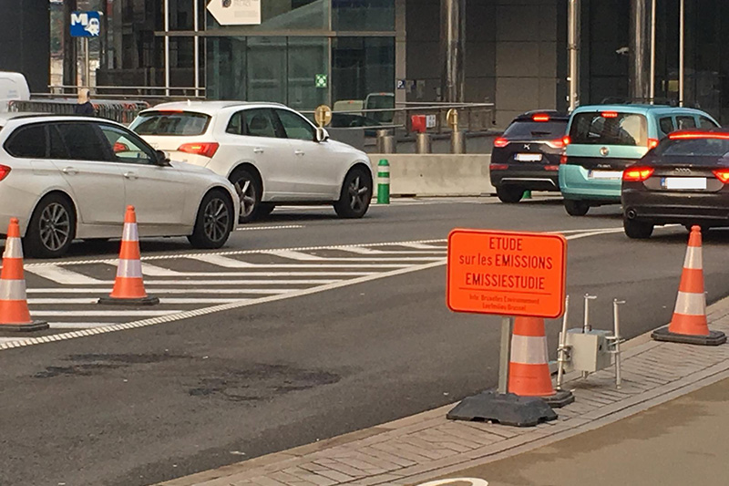
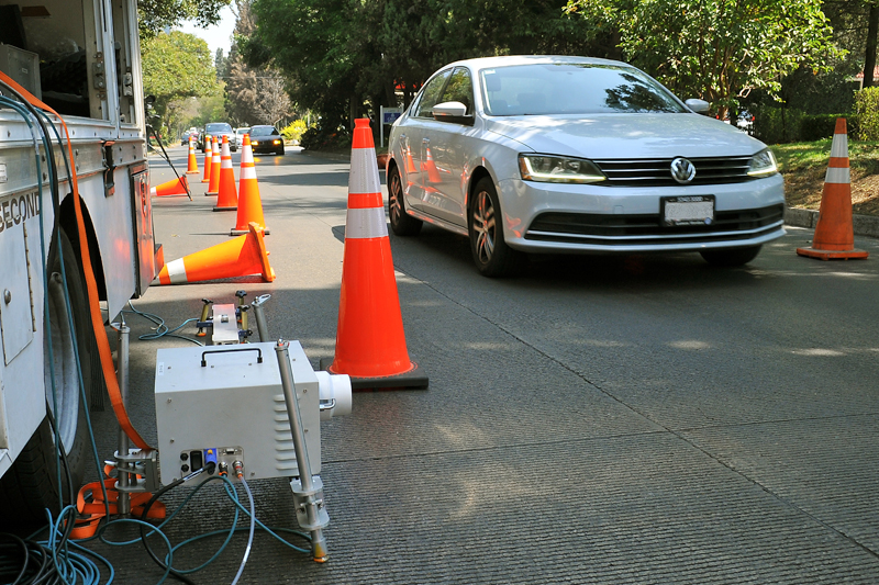
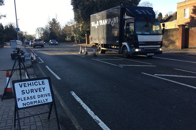
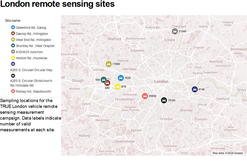
In London, researchers used remote sensing technology to measure the emissions from more than 100,000 vehicles during a five-month sampling campaign that stretched from November 2017 through March 2018. Measurements were made on a total of 45 days at nine locations throughout the Greater London area. The map below shows the location of each site, as well as the total number of vehicle emission measurements made at each location.
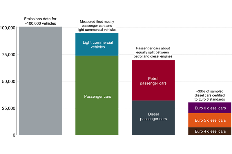
The TRUE London remote sensing data set is among the largest of this type collected in Europe to date. Of the 100,000 vehicles whose emissions were measured, most were light-duty vehicles, including passenger cars and light commercial vehicles. Of particular note are the close to 10,000 measurements of diesel passenger cars certified to Euro 6 emission standards included in the data set. These data will facilitate an in depth look into the performance of the newest diesel cars on London’s roads, and will help to shed light on how on road emissions from these vehicles compare to emissions measured in the laboratory.
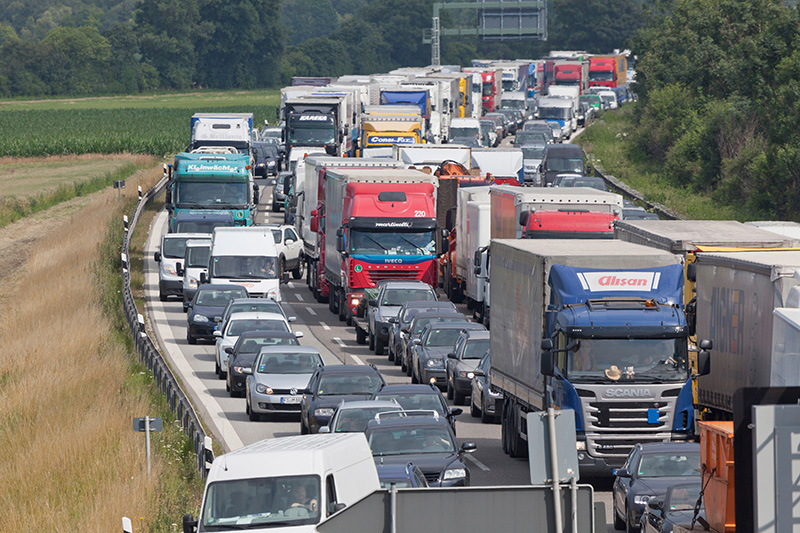
While most of the data collected during the London remote sensing study were for light-duty vehicles, there were also a considerable number of emissions measurements of other vehicle types, such as heavy trucks, buses, taxis, and motorbikes. Although these vehicles make up a smaller percentage of the London fleet, they can contribute disproportionately to total motor vehicle emissions in the city due to, for example, high pollution emission rates (older diesel trucks and buses) or greater utilization (taxis). The TRUE remote sensing data will provide information on the emissions from these vehicle types and will contribute to a better understanding of their contributions to motor vehicle pollution in the London area.
The sheer scale of the TRUE London remote sensing data set means there is a lot of interesting information to dig into. Detailed analysis of the data will be performed in the coming months, including evaluations of emissions by vehicle type, fuel type, and Euro standard. The data will also allow for comparisons to remote sensing data collected in other cities, as well as previous measurements made in London. The London data will be incorporated into a growing database of remote sensing measurements, compiled and maintained by members of the CONOX group. This database, which now contains close to 1 million remote sensing records, provides unique insights into the real-world emissions of European motor vehicles and forms the basis of the TRUE real-world passenger vehicle emissions rating scheme. Looking forward, the data collected during the London remote sensing study will provide government officials, researchers, and the citizens of London with better information by which to evaluate motor vehicle pollution in the city.